

29 Nov
2013
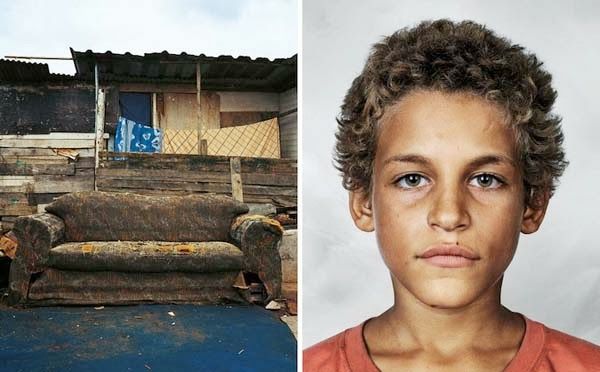
11/29 Art: Where Children Sleep by James Mollison


Please click to see each photo by itself.
Where Children Sleep is a project by photographer James Mollison that shows children from around the world and where they sleep at night.
Where Children Sleep is available for purchase on Amazon as an art book; it gives an intimate perspective of these children. You can get a glimpse of what their lives are truly like (and how they are different from your own) by just looking at their personal bedrooms. Read more at: http://www.amazingoasis.org/2013/11/no-thats-not-just-old-dirty-couch-what.html
H/T Amazingoasis.org and PM